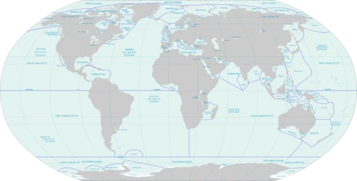
Strait of Juan de Fuca
Main outlet of the Salish Sea to the Pacific Ocean.
The Strait of Juan de Fuca runs roughly 96 miles between Vancouver Island and Washington’s Olympic Peninsula, acting as the main channel connecting the Salish Sea to the Pacific Ocean. The Canada–U.S. border follows the middle of this waterway. It was named in 1787 by Charles William Barkley, a fur trader captaining the *Imperial Eagle*, after a Greek sailor named Juan de Fuca. According to his own account, de Fuca had joined a Spanish expedition in 1592 looking for the mythical Strait of Anián. Barkley is the first person known to have actually found the strait—unless de Fuca’s story was true.
Some later historians have questioned that story. In 2003, Samuel Bawlf argued that de Fuca’s tale was likely a fabrication meant to extract money from the English government, possibly based on Francis Drake’s 1579 exploration of the Northwest Passage at its western end. If so, Drake might have been the first European to see the strait’s entrance and even to sail through it, heading west around Vancouver Island, through the Strait of Georgia, and sighting the entry to Puget Sound. Bawlf’s theory relies on geographic details that began leaking after Drake’s return and appearing on maps like Ortelius’s. He suggested the story originated with a pilot named Morera from Drake’s expedition, who supposedly returned alone and was later arrested by the Spanish.
Although the U.S. Geological Survey says John Meares named the strait in 1788, most sources—including the BC Geographical Names Information System, the Washington Secretary of State, and several historical atlases—credit Barkley with the 1787 naming. It is well known that Meares tried to claim credit for much of Barkley’s work. Between 1789 and 1791, the strait was thoroughly explored by Manuel Quimper, José María Narváez, Juan Carrasco, Gonzalo López de Haro, and Francisco de Eliza.
The U.S. Geological Survey defines the strait as a channel. It stretches east from the Pacific, between Vancouver Island and the Olympic Peninsula, to Haro Strait, San Juan Channel, Rosario Strait, and Puget Sound. Its Pacific boundary runs from Cape Flattery and Tatoosh Island, Washington, to Carmanah Point on Vancouver Island. The northern boundary follows Vancouver Island’s shoreline from Carmanah Point to Gonzales Point, then a line east to Seabird Point (Discovery Island), Cattle Point (San Juan Island), Iceberg Point and Point Colv
- length
- 96 miles (83 nmi; 154 km)
- named_by
- Charles William Barkley in 1787
- named_for
- Juan de Fuca
- countries
- Canada and United States
- climate_classification
- Disputed: Mediterranean (Köppen) or oceanic (most regional climatologists)
- notable_ferry
- MV Coho (Port Angeles to Victoria, since 1959)
Lore & Background
The strait was named in 1787 by Charles William Barkley, captain of the Imperial Eagle, for Juan de Fuca, a Greek navigator who claimed to have sailed in a Spanish expedition in 1592 seeking the Strait of Anián. Barkley was the first recorded person to find the strait, unless Juan de Fuca's story was true. In 2003, Samuel Bawlf argued that Fuca's story was a fabrication designed to extract money from the English government, possibly based on Francis Drake's 1579 exploration of the Northwest Passage. The strait was explored in detail between 1789 and 1791 by Manuel Quimper, José María Narváez, Juan Carrasco, Gonzalo López de Haro, and Francisco de Eliza.
The climate of the strait is disputed: the Köppen system classifies it as Mediterranean, but most regional climatologists prefer oceanic. Rainfall ranges from over 100 inches (250 cm) at the west end to as little as 16 inches (410 mm) at the east end near Sequim. The strait remains the subject of a maritime boundary dispute between Canada and the United States, specifically over the seaward boundary extending 200 nautical miles west from the mouth. The government of British Columbia argues that the Juan de Fuca submarine canyon is the appropriate boundary, based on the principle of natural prolongation.
Reader's Guide
The Strait of Juan de Fuca is significant as the primary connection between the Salish Sea and the Pacific Ocean, and as the location of the international boundary between Canada and the United States. Its naming history involves disputed claims: most sources credit Charles William Barkley in 1787, though the U.S. Geological Survey says John Meares named it in 1788. The strait's climate, while debated in classification, supports a range of ecosystems from temperate rainforest to dry conditions. Ecologically, it hosts migrating common murre, humpback whales (observed June to November), resident and transient killer whales, and gray whales. The strait is also a site of ongoing maritime boundary negotiations, complicated by its potential influence on other unresolved disputes. The name 'Salish Sea' was officially adopted in 2009 by geographic boards of Canada and the United States as a collective term for the Strait of Juan de Fuca, Strait of Georgia, and Puget Sound, not replacing the individual names. The MV Coho ferry has crossed the strait since 1959, carrying passengers and vehicles between Port Angeles and Victoria.
Did You Know?
- The strait was named in 1787 by Charles William Barkley, though the U.S. Geological Survey says John Meares named it in 1788.
- Rainfall ranges from over 100 inches (250 cm) at the west end to as little as 16 inches (410 mm) at the east end near Sequim.
- The MV Coho ferry began operating in 1959 and carried 475,000 passengers and 130,000 vehicles in 2018.
- The strait is part of a maritime boundary dispute between Canada and the United States over the seaward boundary extending 200 nautical miles west.
Frequently Asked Questions
What is the Strait of Juan de Fuca?
It is a roughly 96-mile waterway that separates Vancouver Island from Washington's Olympic Peninsula and serves as the primary passage linking the Salish Sea to the open Pacific Ocean.
Who named the Strait of Juan de Fuca and after whom?
Fur trader Charles William Barkley gave it that name in 1787, honoring a Greek sailor called Juan de Fuca who claimed to have reached the passage during a 1592 Spanish expedition searching for the fabled Strait of Anián.
How does the Canada–U.S. border relate to the strait?
The international boundary between the two countries runs down the centerline of the waterway, so the strait effectively splits into Canadian and American halves.
What is the Strait of Juan de Fuca's main geographic role?
It acts as the chief outlet through which the Salish Sea drains into the Pacific, making it a critical chokepoint for marine traffic and ocean currents in the region.
What notable ferry crosses the Strait of Juan de Fuca?
The MV Coho has linked Port Angeles, Washington, with Victoria, British Columbia, since 1959, providing a key passenger and vehicle crossing between the two countries.
More in Straits, Channels, And Seas 1-24
Spotted an error? Know more?
This is a living reference — every entry is fact-audited, and reader corrections feed straight into our audit queue. Suggest an edit · See this site's audit record